Archaeogeophysical Survey (2010, 2011)
Introduction
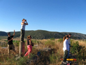
The systematic archaeogeophysical survey in the Mycenaean citadel of Glas in Kopais is conducted under the auspices of the Athens Archaeological Society and the direction of Prof. Christofilis Maggidis (2010, 2011), funded by Dickinson College and the INSTAP. The geophysical survey is conducted by a team of archaeologists, graduate and undergraduate students, and teams of specialists from INSTAP, led by Prof. A. Stamos, and the Exploration Geophysics Laboratory of the Univ. of Thessaloniki, led by Prof. Gr. Tsokas.
Aims of Geophysical Survey
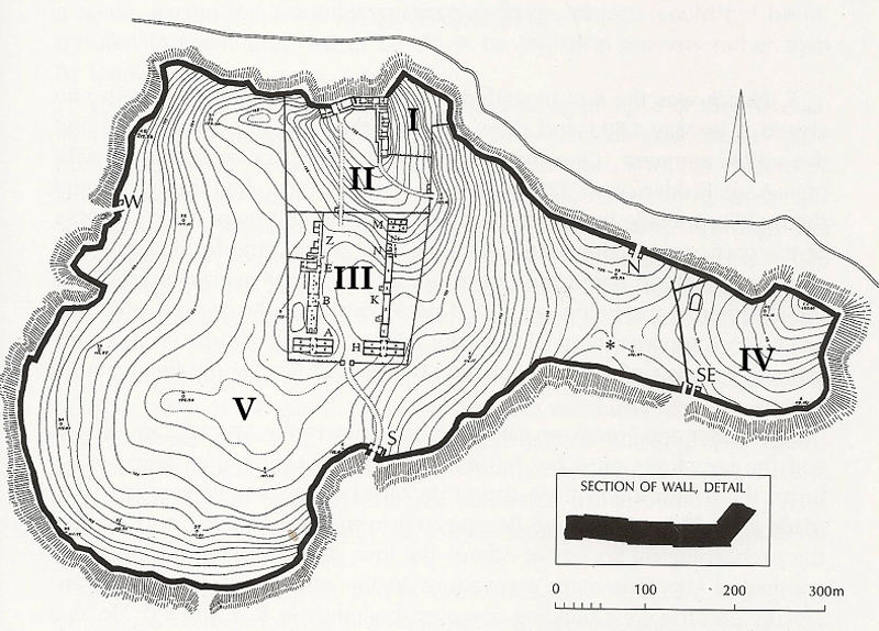
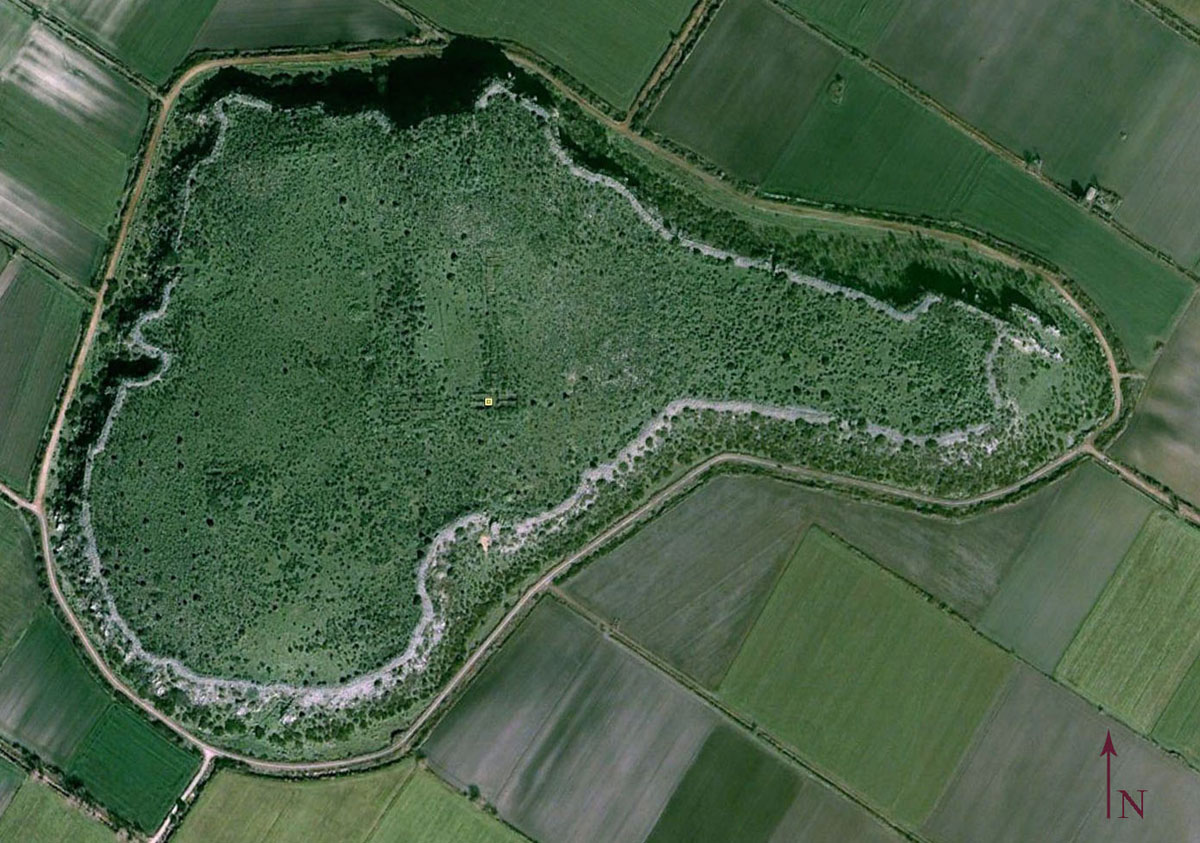
The current form and lay-out of the citadel of Glas presents certain spatial peculiarities:
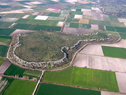
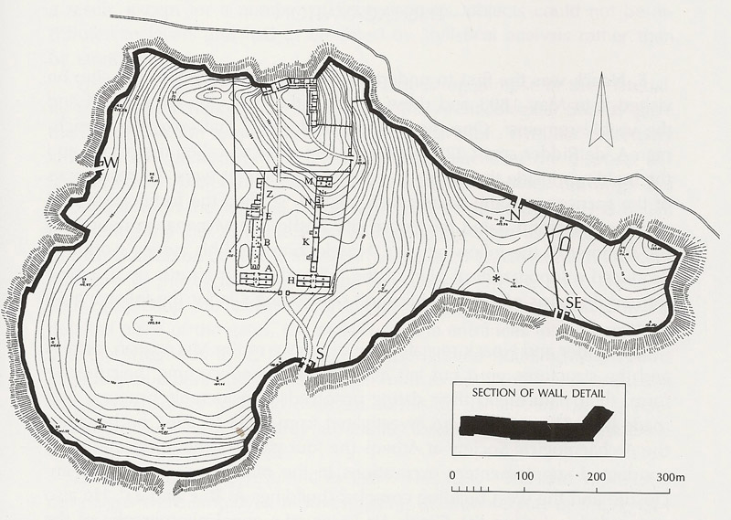
(1) one third or less of the total area of the citadel (49.5 acres or 20 ha) is occupied by various buildings and structures, whereas no other ruins have been located so far by surface survey anywhere else in the citadel (V);
(2) the northern and southern enclosures surround and demarcate groups of buildings within the citadel, delineate their spatial arrangement, differentiate between storage areas and administrative or residential sectors, and isolate these sectors from the remaining fortified area for some elusive reason (II, III);
(3) the northeastern enclosure contains no visible ruins, bears no definite entrance (except perhaps a couple of gaps in the peribolos wall that may have provided access), and its use remains obscure (I);
(4) the eastern enclosure of the citadel is separated and isolated from the remaining fortified area being apparently accessible only from outside the walls through the eastern entrance of the double Southeast Gate, and its precise use –being void of any visible ruins– remains unclear (IV).
The systematic geophysical survey of the citadel of Glas focuses on unexplored areas and excavated sectors aiming to produce new architectural evidence and further define the topography, lay-out, and use of the citadel, as well as trace earlier occupation phases of the site. The project involves:
• remote-sensing investigation of the northern and southern enclosures (II, III) to trace potentially other Mycenaean buildings, subsidiary structures, storage areas, retaining walls, terraces, courtyards, and roads;
• remote-sensing investigation of the vast ‘void' fortified area (V) to detect potentially a Mycenaean settlement within the citadel and/or earlier occupation remains on the hill of Glas (as suggested by scattered Neolithic pottery and stone tools);
• remote-sensing investigation of the northeastern enclosure (I) and the eastern enclosure of the citadel (IV) to detect potentially Mycenaean ruins or diagnostic geomagnetic traces of human activities related to the use of land (e.g. cultivation, extensive burning, metallurgy, walking surfaces and artificial terracing).
The geophysical survey of the citadel of Glas complemented by M. Lane's AROURA geophysical project in the surrounding region may produce significant new evidence on the dynamics between the regional administrative center and its satellite peripheral settlements in the Kopais basin. Furthermore, it will complement the intensive archaeological fieldwork in Thebes and Boeotia which is conducted by V. Aravantinos and the 9th Ephorate of Prehistoric and Classical Antiquities, by exploring and further defining the size, lay-out, and use of the citadel of Glas.
Methods of Geophysical Survey
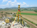
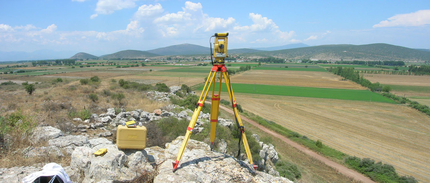
Aside from certain areas of the citadel (plateaus or steep slopes) that have been severely eroded down to the natural bedrock, the natural fill of the hill is approximately 1m deep or deeper, when it contains artificial fills, archaeological layers, and ruins. The geophysical remote-sensing survey is conducted with a Ground Penetrating Radar (GPR) and a Fluxgate Gradiometer. Both types of equipment produce detailed images to a depth of 2 meters. The portable geomagnetometer (Geoscan FM256 Fluxgate Gradiometer processed with Geoplot software) detects positive or negative anomalies in the magnetic field of the Earth and records them as dark grey or black features (positive magnetic anomalies potentially reflecting ditches, backfills, clay floors, intense firing, burnt mudbrick, metal finds) and light grey or white features (negative magnetic anomalies possibly indicating stone walls, pavements, stone piles). The fluxgate gradiometer offers several advantages, namely speed of geoprospection (on average one acre per day), portability, and use on irregular terrains or over low vegetation, as it does not involve any contact with the ground; on the down side, however, the gradiometer reproduces two-dimensional geoprospection images of the magnetic traces which are conflated and compressed on a single plane without any real indication of depth. On the other hand, the GPR (Subsurface Interface Radar or SIR-2000 with a 400MHz antenna) is considerably slower, as it is wheeled on the ground and, therefore, requires extensive preparatory work in the form of surface clearing; furthermore, it involves collection of data in two perpendicularly-oriented datasets with repeated passing on closely-spaced transects of an orthogonal grid to better detect subsurface features. The GPR, however, generates three-dimensional geoprospection images of the buried remains (stone walls and floors, rubble piles) with precise depth scale. Electrical Resistivity is also employed with very good results.
The vast size of the citadel, the occasionally rough terrain and wild bush vegetation on the hill, and the need for time efficiency dictate a well-planned combination of both methods: at first, extensive and generalized use of the gradiometer for fast and immediate results, followed by targeted use of the GPR on select areas or sectors that present strong or diagnostic geomagnetic traces. Such combination of these two methods proved exceptionally successful and precise at Mycenae (2003-2011), where the systematic geophysical survey detected, recorded, and plotted extensive remains of the Lower Town outside the citadel, including roads, retaining walls, buildings, large complexes, and an outer fortification wall with at least two gates.
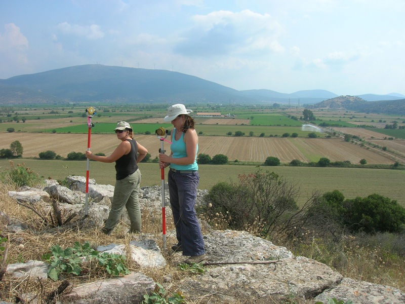
Geodetic measurements, the plotting of the survey grid, and the detailed mapping of all buried remains and features are done with the aid of Differential Global Positioning System (GPS) and Total Station. The topographical, archaeological, spatial, and geophysical data will be embedded in the G.I.S. database of Dickinson College and 3-D digital maps. Upon completion of the project, the final conclusions of the geophysical survey of the citadel of Glas and digital geoprospection maps will be published in the series of the Library of the Archaeological Society at Athens as a supplement to the published volumes Glas I and II (Glas ΙΙΙ : The Geophysical Survey of the Citadel ).
Preliminary results of the first survey phase (2010, 2011)
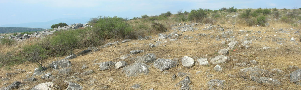
The geophysical survey focused first on the two large northern enclosures (I, II) and the western sector of the citadel (V) to the axis of the South Gate. The indications from the enclosures were rather poor due to severe ground erosion on the summit and the slopes. The results, however, from the western sector of the citadel and the cyclopean fortification wall were impressive. Several buildings were detected, including three well-built large complexes (D, F, H) consisting of long rectangular buildings with several large rooms. Clusters of walls, rooms, and small buildings (E, G) were located between the large complexes, occasionally abutting on the inner face of the cyclopean wall. A low hill in the southwestern sector which contains complex F may also enclose other important structures.
The West Building which lies in the northwestern part of the citadel with an E-W orientation, is an oblong rectangular structure divided by at least four parallel partition walls into a row of five rooms, with the central two rooms being of equal size. Another parallel room and few wall remains were traced immediately south of the West Building with which they may be connected.
A
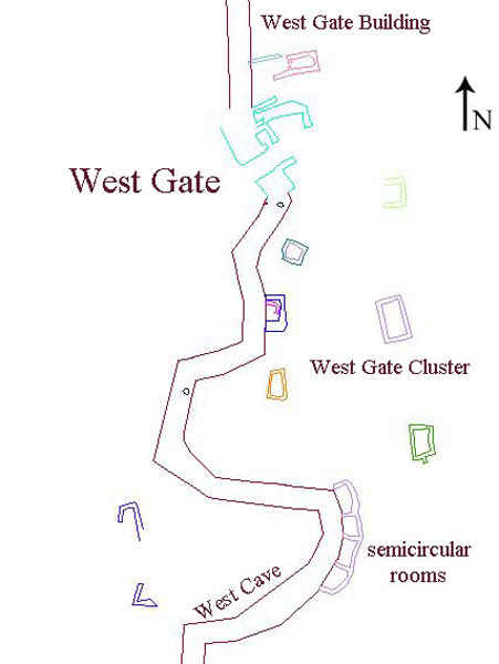
cluster of scattered rooms in the vicinity of the West Gate were further explored, which
may belong to a residential quarter, as indicated by their small size, simple plan, different
orientation, and relatively poor construction. Among them, immediately north of the West Gate,
lies a two-room (guard house?) abutting on the inner face of the western cyclopean wall (West
Gate Building), while, farther south of this gate, four semi-circular rooms (silos?) were built
against a recess of the western cyclopean wall.
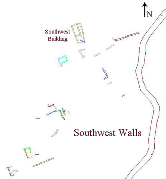
The southwestern area of the citadel is accessible from both the West Gate and the South Gate, and is dominated by the plateau of a low hill which is occupied by a large building complex and possibly enclosing other important structures as well. The Southwest Complex consists of at least three parallel, oblong rectangular wings of similar ground plan and same orientation as the West Building. This complex has solid walls constructed of roughly dressed, large blocks and its wings are divided by parallel partition walls into rows of large rooms. The size, construction and ground plan of the Southwest Complex and the West Building recall the two parallel long storage buildings in the southern central enclosure (Sector III: B, C). Another cluster of scattered buildings, rooms, and wall remains (Southwest Cluster) were detected to the southeast of the Southwest Complex, which may belong to a residential quarter, as indicated by their relatively small size, simple plan, different orientation and construction.
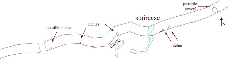
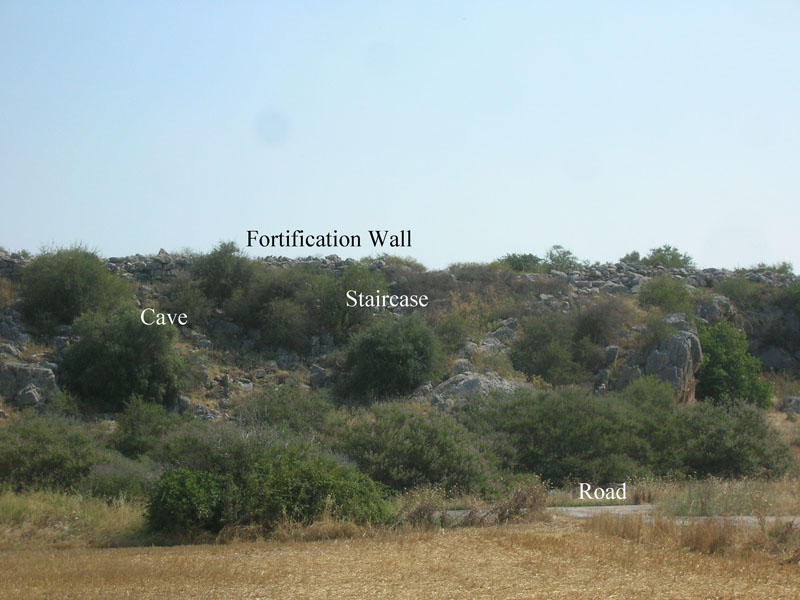
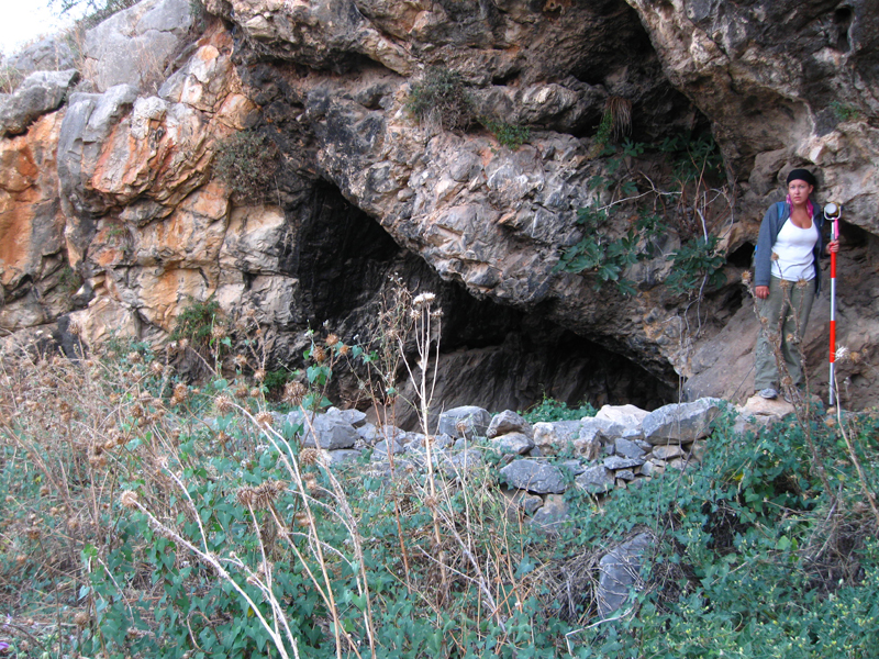
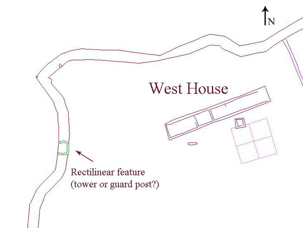
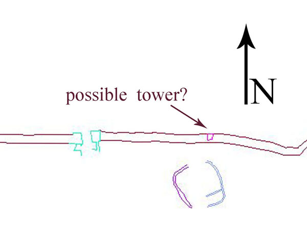
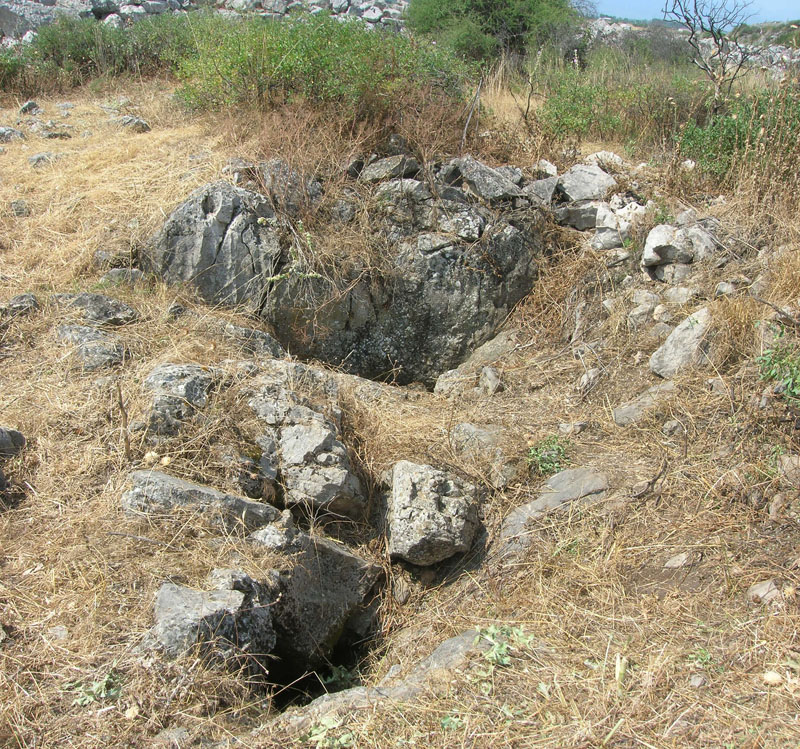
In the southern sector of the cyclopean wall, approximately midway between the West and the South Gate, two sally ports were discovered which raise the number of gates in the citadel of Glas to six. The southwest sally port is 3m wide and gives access to a low terrace in front of the wall that affords unobstructed viewing of the plain to the south. The other sally port, located 60m to the east, facilitates safe descent to the plain below via a narrow and steep staircase that was partly built and partly hewn out of the bedrock and provides access to a cave at the base of the rocky hill. Between the two sally ports were identified five narrow rectangular niches (1m x 3m) opening into the outer face of the wall with no access from within the citadel, but once accessible possibly through trapdoors from the upper part of the wall. These niches were likely sentry boxes associated with the guarding of the adjacent sally ports. Two more niches were located in the northern and western sectors of the cyclopean wall. Finally, traces of large rectangular rooms (casemates or towers) were detected within the thickness of the cyclopean wall in the western sector (100m north of the west gate), in the northeastern sector (70m east of the north gate), and in the southwestern sector (200m west of the south gate and east of the sally ports).
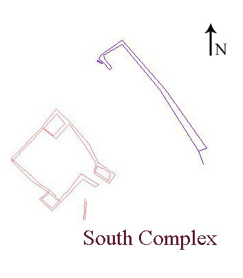
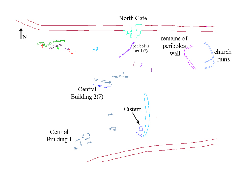
The geophysical survey expanded eventually in the central and the
eastern part of the citadel with equally impressive results. In the central area (Sector
V) lies the South Complex
which consists of a large building with a NW-SE orientation, flanked by a parallel oblong
rectangular wing. Farther to the northeast of this complex were detected a cluster of scattered
buildings, rooms, and wall remains (Central
Cluster), including a multi-room building (Central Building
1), an oblong rectangular wing of another building with an E-W orientation (Central
Building 2), and a
cyclopean cistern, partly built and partly hewn out of the bedrock, which is associated
with a long retaining wall with a N-S orientation. The oblong wings of the central buildings,
though smaller in size, are similar to those of the West Building and the Southwest Complex.
The eastern part
of the citadel (between Sectors IV and V) preserves a surviving corner of the cross-wall
which ran at an angle from the northeastern course of the cyclopean wall to the central tower of
the double Southeast Gate. This cross-wall separated and isolated the eastern part of the
citadel (Sector IV) which was, thus, accessible only from the eastern entrance of the double
Souteast Gate. This isolated eastern sector of the citadel contained scattered structures (East
Cluster), including several retaining walls for terracing with an E-W orientation, walls and
rooms of various buildings, and at least ten
circular structures (2,5-3m in diameter), possibly silos(?). Six of these circular
structures are located in the center of the eastern sector, while four more were traced near the
northeastern course of the cyclopean wall. Outside the eastern course of the cyclopean wall was
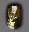
found a built staircase (East Staircase); furthermore, several caves and sinkholes were located,
mapped, and briefly surveyed at the foot of the rocky hill of Glas.
The archaeological picture of Glas, therefore, is changing drastically. Until now, the citadel of Glas presented the lay-out of a fort with certain spatial peculiarities: only one third or less of the total area of the citadel (49.5 acres or 20 ha) seemed to be occupied by various buildings and structures (administrative buildings, storage facilities, workshops, kitchens, personnel residence quarters), whereas no other ruins had been located so far by surface survey anywhere else in the citadel; the central enclosures surround and demarcate groups of buildings within the citadel, delineate their spatial arrangement, differentiate between storage areas and administrative or residential quarters, and isolate these sectors from the remaining fortified area for some reason. This reason is no longer elusive: the citadel of Glas was not left void of structures outside the central enclosures after all, but was apparently covered with many buildings of various uses, including at least five large and well-built complexes, extensive residential quarters and clusters of buildings stretching between these complexes, (semi)circular structures (silos?), a cistern, staircases, retaining walls and terraces.
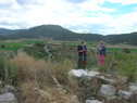
The systematic investigation of the Mycenaean citadel of Glas will continue and intensify in the next decade. The geophysical survey which will focus on the eastern (Sector IV) and the western part of the citadel (Sector V), while systematic excavation will target select building complexes, clusters, and structures.
.jpg)
_1.jpg)
 2011 (labeled).jpg)
.jpg)
 2011 (labeled).jpg)
.jpg)
.jpg)
.jpg)